Rancho Jamul Mitigation Bank, Phase IIB
The sold-out first phase of the Rancho Jamul Mitigation Bank was approved in 2000 and included the re-establishment, rehabilitation, and enhancement of riparian and wetland habitat within the Rancho Jamul Ecological Reserve in San Diego County, California. The Bank identified two phases of re-establishment, rehabilitation, and enhancement activities; Wildlands has already implemented Phases IA and IB of the Bank and is currently proposing to establish Phase IIB of the Bank just north and east of the Bank’s Phase I restoration area.
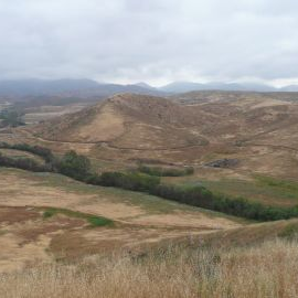
Phase IIB of the Bank proposes to conduct additional stream and wetland restoration in the form of wetland re-establishment along Jamul Creek and its tributaries. Creek corridors throughout the Rancho Jamul Ecological Reserve have been degraded by a long history of intensive agricultural use and grazing. Over time the stream channels have become entrenched and now lack connection with their adjacent floodplain terrace, which limits riparian habitat development. In some areas along Jamul Creek, the bed of the channel is 15 to 20 feet below the valley surface.
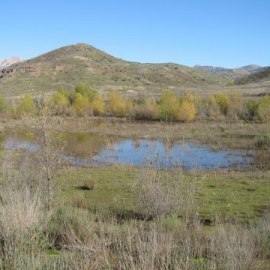
Riparian habitat along these corridors lacks structural diversity and is often confined in width to the extent of the channel’s bed and bank. Much of the habitat within the surrounding inactive floodplain is dominated by ruderal, non-native vegetation. Groundwater levels continue to fall with increasing channel incision, further limiting riparian and wetland habitat development in the adjacent creek corridor/inactive floodplain. Additionally, ephemeral streams routing seasonal surface water to Jamul Creek have been diverted into a high line ditch, reducing water inputs that would otherwise be available to support wetland and riparian habitat. To date, over 55 acres of riparian and wetland re-establishment, rehabilitation, and enhancement has occurred through the initial phases of the Bank. Through the establishment of Phase IIB, an additional 26 acres of stream and riparian floodplain habitat would be re-established by re-aligning/relocating the existing stream channel to an area that historically supported wetlands. Restoration through re-establishment would ameliorate continuing channel incision and create a sustainable solution for riparian wetland improvements and the associated ancillary species benefits.
Phase IIB is currently under review with the regulatory agencies: California Department of Fish and Wildlife, the Los Angeles District of the U.S. Army Corps of Engineers (“USACE”), Region IX of the U.S. Environmental Protection Agency (“USEPA”), San Diego Regional Water Quality Control Board (“RWQCB”), and the California Department of Fish and Wildlife (“CDFW”), South Coast Region.
Gallery
250 acres
Location: San Diego County, California
Mitigation Types
- Wetland/Waters of the U.S.
- Wetland/Waters of the U.S.
- Waters of the State
- Riparian
- Riparian
Service Area
- IN ENTITLEMENT, CALL FOR AVAILABILITY -
- The Waters of the U.S. and RWQCB Waters of the State Primary service area includes portions of the San Diego River 8-digit HUC (18070304) and Cottonwood Creek-Tijuana River 8-digit HUC (18070305); the Secondary service area includes the remaining 10-digit HUCs within the San Diego River and Cottonwood Creek-Tijuana River 8-digit HUCs as shown in the service area map.
- The CDFW Waters of the State service area corresponds with the Waters of the U.S. and RWQCB Waters of the State Primary service area, as shown in the service area map.
Note: The use of credits within the Primary and Secondary Service Areas are at the discretion of the applicable regulatory agency(ies) and may be subject to limitations; please contact us for more information.
Approving Agencies
- Regional Water Quality Control Board
- California Department of Fish & Wildlife
- U.S. Army Corps of Engineers
- U.S. Environmental Protection Agency
For additional information on the Rancho Jamul Mitigation Bank, Phase IIB, please contact Julie Maddox at (916) 435-3555 or jmaddox@heronpacific.com.


